BEST LEARNING i-Poster: My Europe Interactive Map
i-Poster Series | Electronic Learning Charts Collection by BEST LEARNING
i-Poster: My Europe Interactive Map
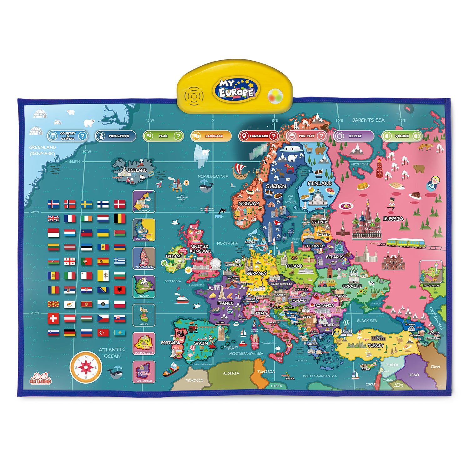
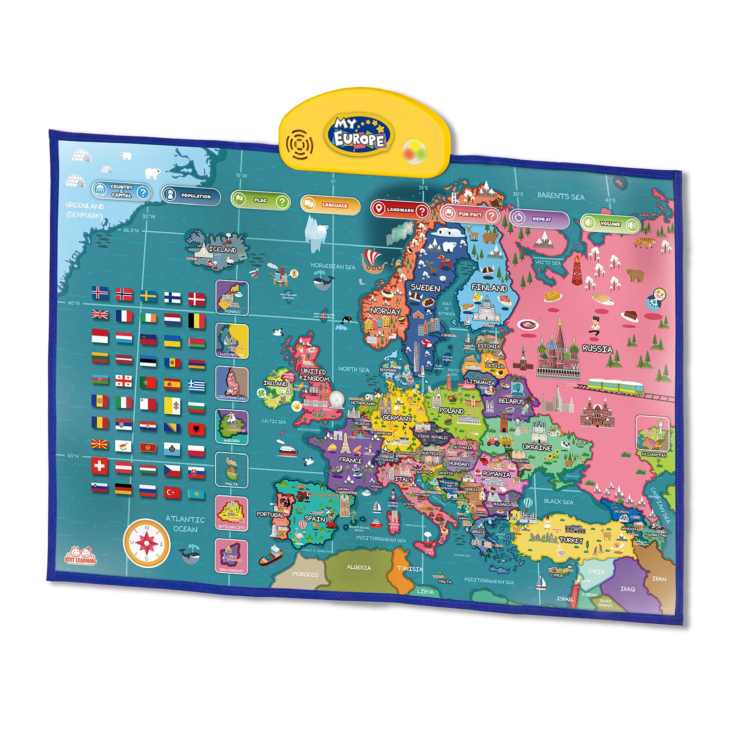
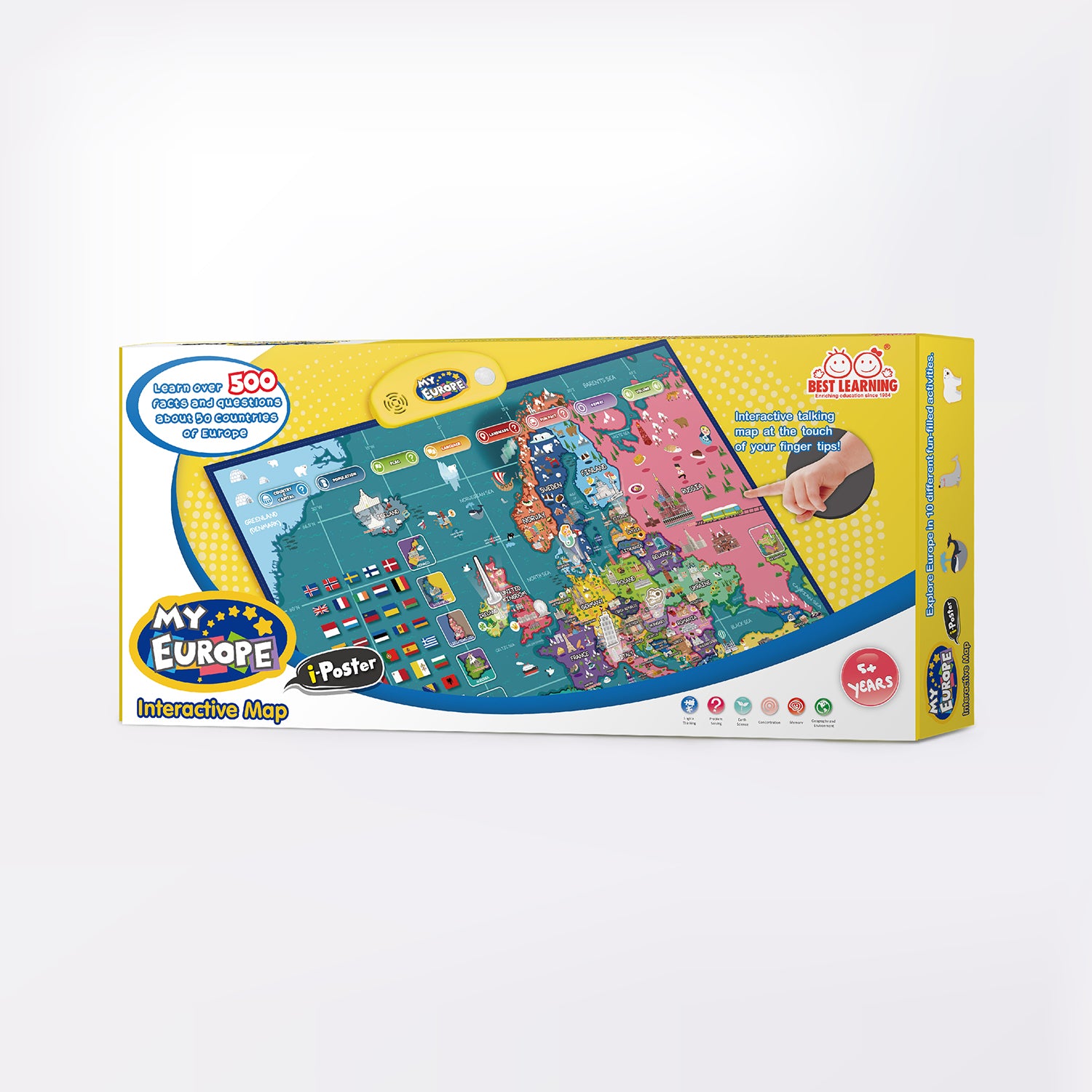
Frustrated with teaching kids to learn geography or don't know how to get started? Try this! An interactive talking Europe map provides children a simple way to get comprehensive concepts about the 50 countries in Europe! Learn about their geography, official country names, capital cities, largest cities, national flags, populations, spoken languages, famous landmarks, fun facts and much more! Both kids and adults can enjoy the hundreds of facts as well the exciting quiz games!

FEATURES
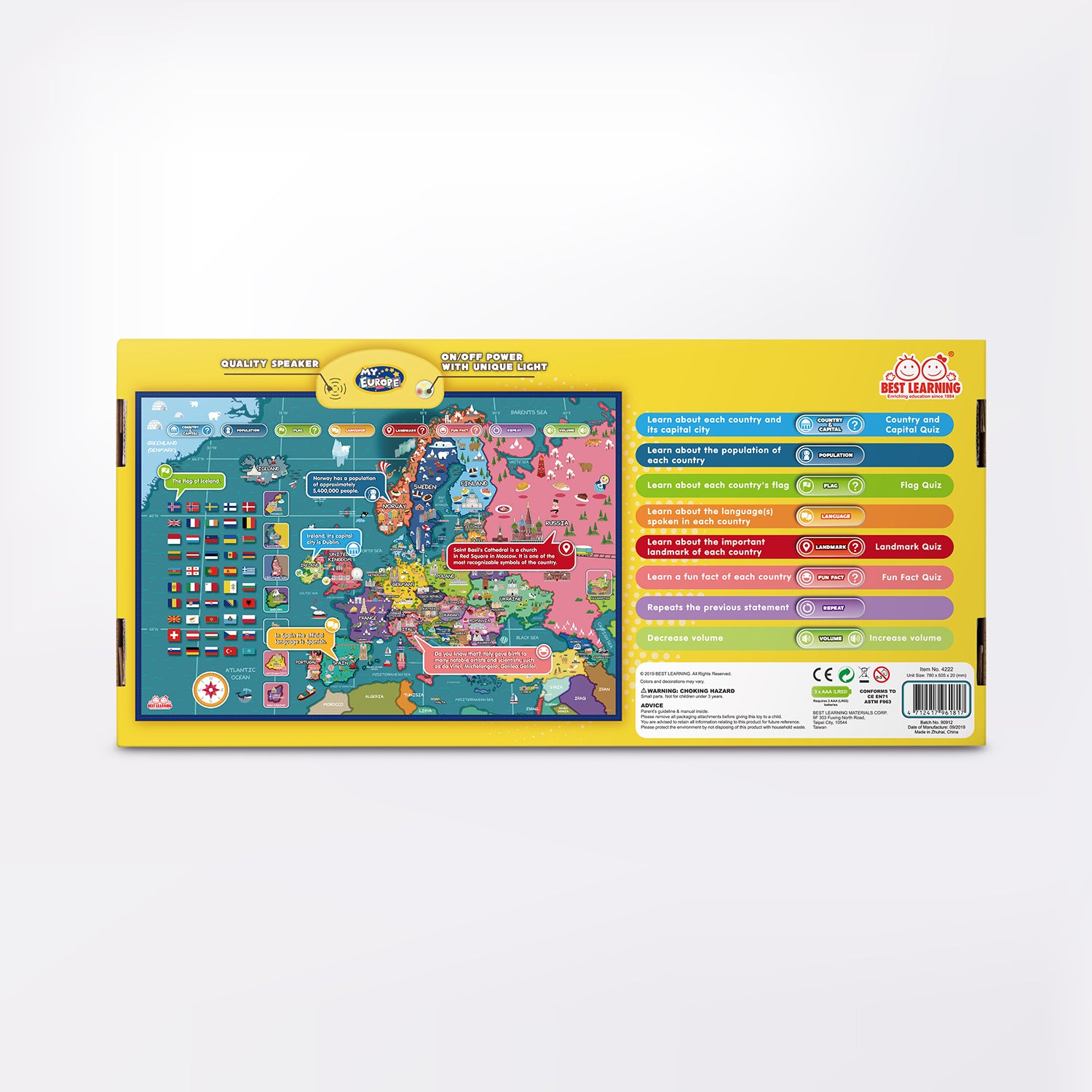
- Official name and capital city of each country.
- The national flag of each country.
- The population of each country.
- The important landmark of each country.
- The language(s) spoken in each country.
- An interesting fun fact or trivia of each country.
- 5 levels of volume adjustments.
- Can repeat the previous statement.

SKILLS LEARNED
- Logical thinking
- Problem solving
- Earth Science
- Concentration
- Memory
- Geography and Environment
 MULTI AWARDS WINNING FUN LEARNING TOY
Family Choice, Mom's Choice Gold Metal & Tillywig Brain Child Award Winner 2018!
Creative Child Seal of Excellence Award Winner 2019!
| Product Dimensions | 30.7 x 23.9 x 0.8 inches |
| Item Weight | 28.16 ounces |
| Recommended age | 5 years and up |
| Batteries | 3 AAA batteries (included) |
Download PDF manuals by product names from letters A to Z.
- Book Reader: Animal Kingdom
- Connectrix
- Connectrix - Junior
- EduQuiz: Basic Set I
- i-Poster: My Body
- i-Poster: My Europe
- i-Poster: My Learning Board
- i-Poster: My Periodic Table
- i-Poster: My United Kingdom
- i-Poster: My USA
- i-Poster: My World
- INNO PAD: Smart Fun Lessons
- Learning Clock
- Learning Cube
- Mushroom Garden
- My First Piano Book
- My Spin & Learn Steering Wheel
- Shake & Learn
- Stack & Learn
- Touch & Learn Tablet
- Whack & Learn Mole